Log in
All resources
Create a design
1,095,966 Free Images of Maps Of Aberystwyth
maps in the library of congress
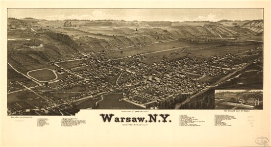
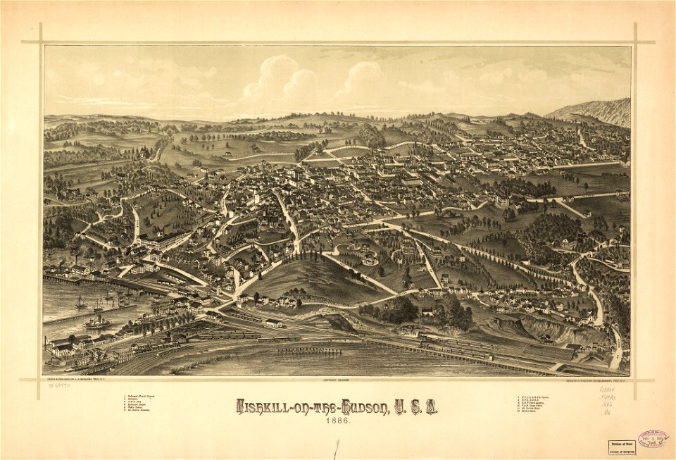
new york
l. r. burleigh
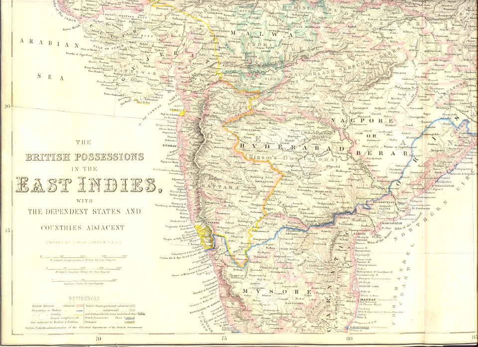
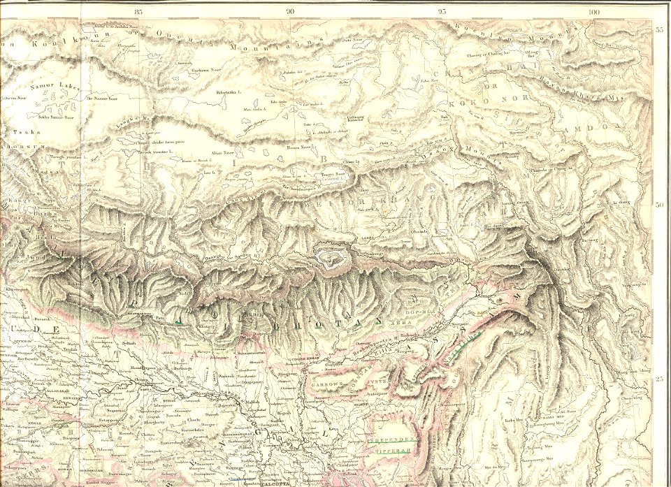
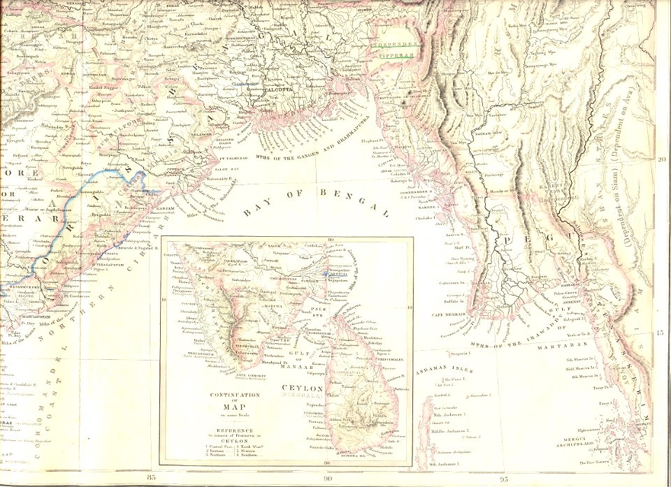
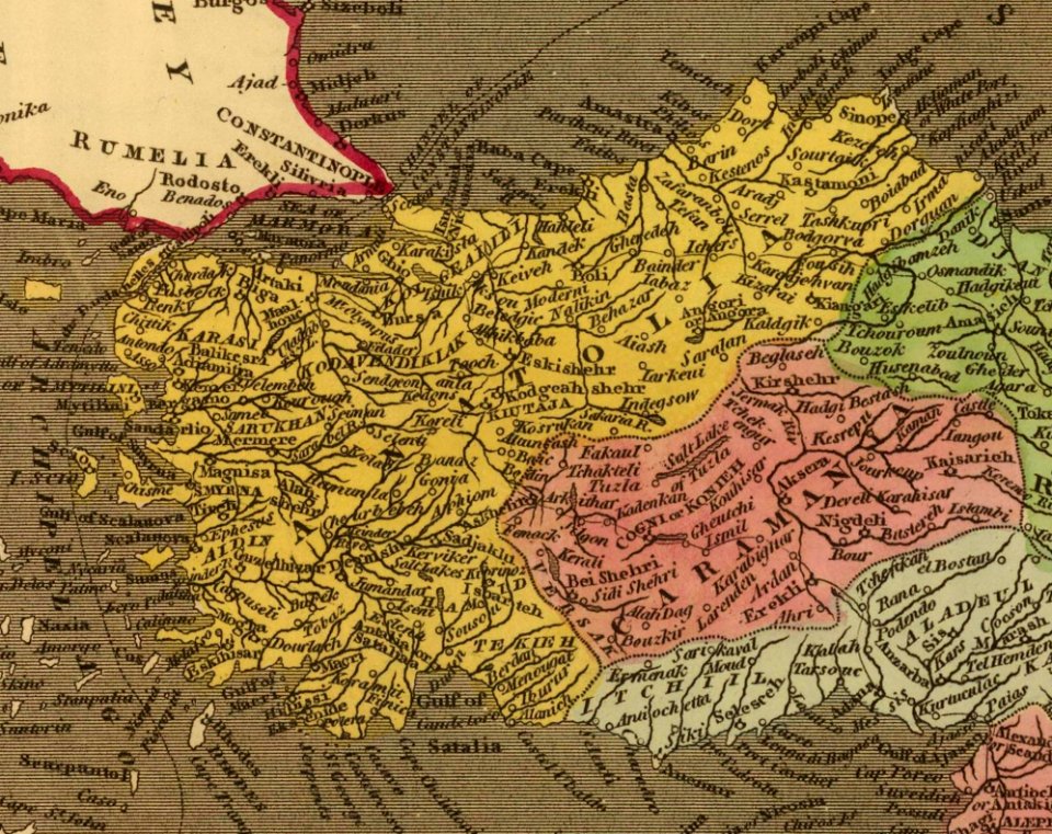
19th-century maps of india
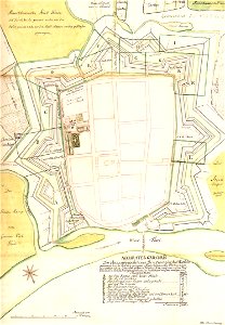
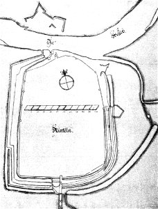
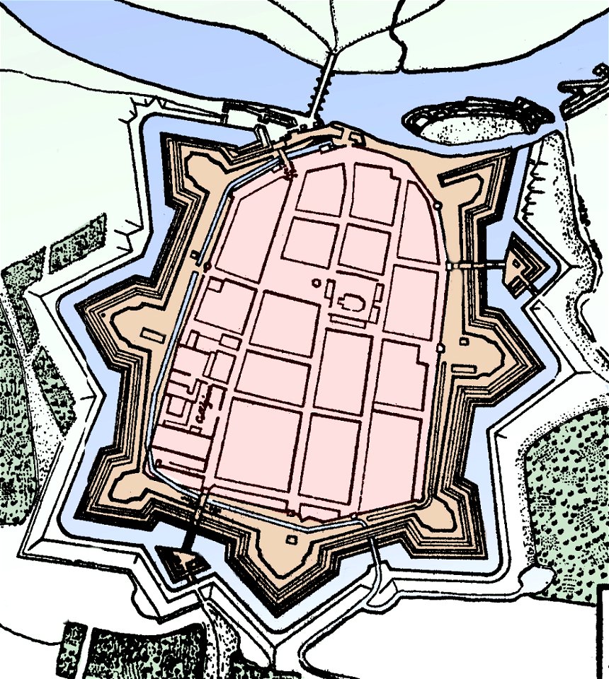
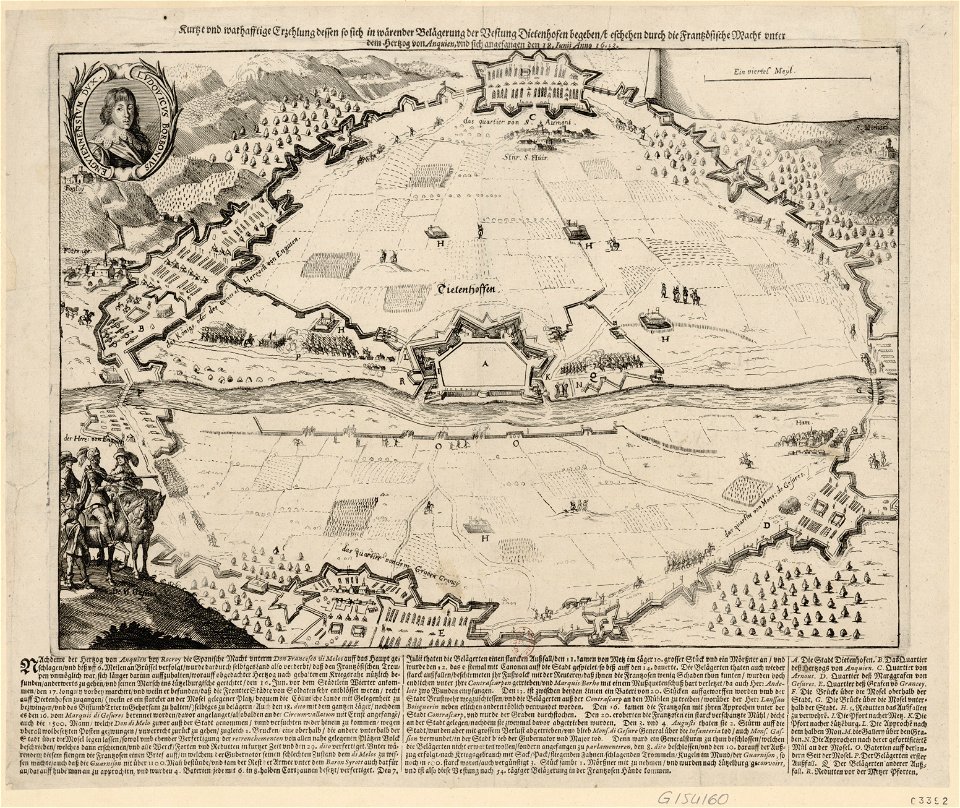
stadtbefestigung rinteln
maps of rinteln
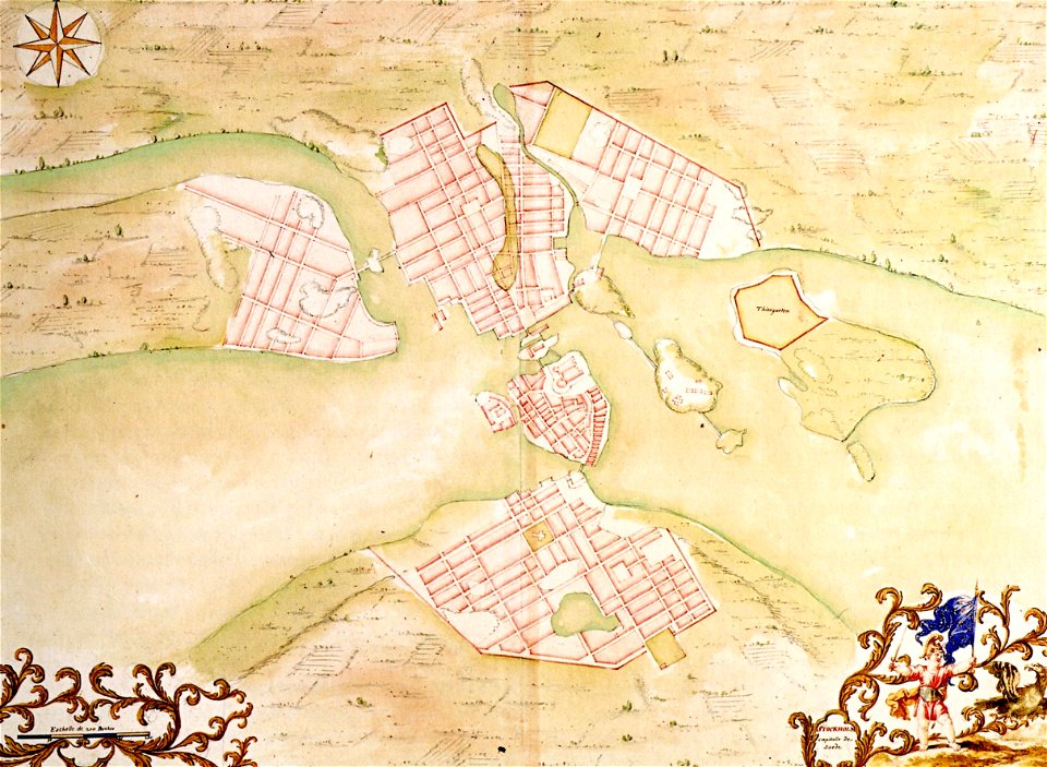
17th-century maps of stockholm
giovanni camocio
david rumsey historical map collection
maps with cartouches
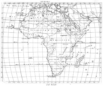
1770s maps of africa
elementarwerk
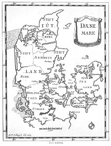
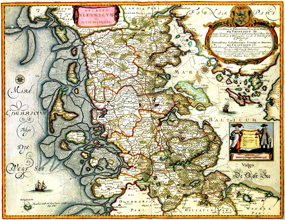
1770s maps of denmark
elementarwerk
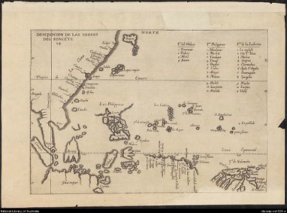
old maps of southeast asia
old maps of ariano irpino
maps of isfahan
pascal coste
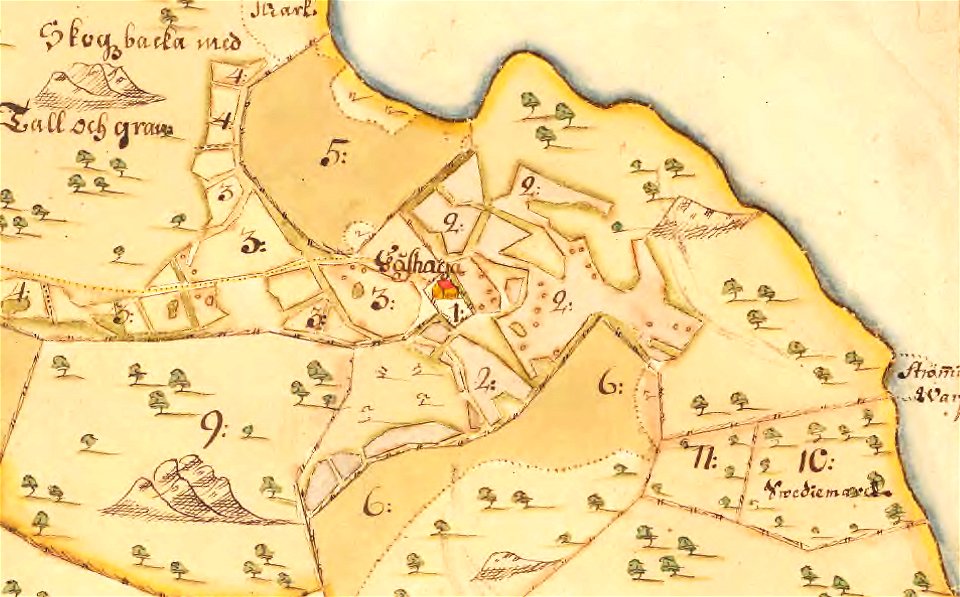
maps of lidingö
gåshaga gård
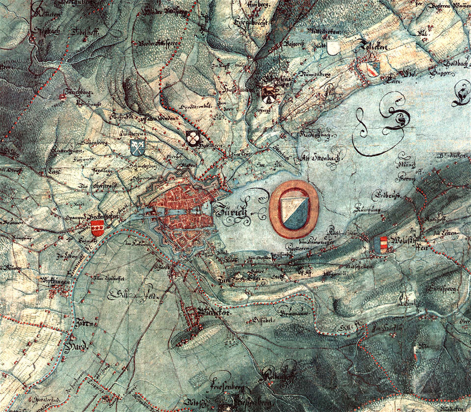
old maps of zürich
gygerkarte
17th-century maps of stockholm
old maps of leipzig
elsterfloßgraben
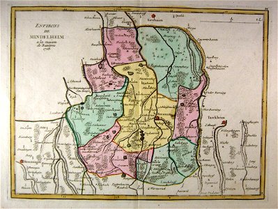
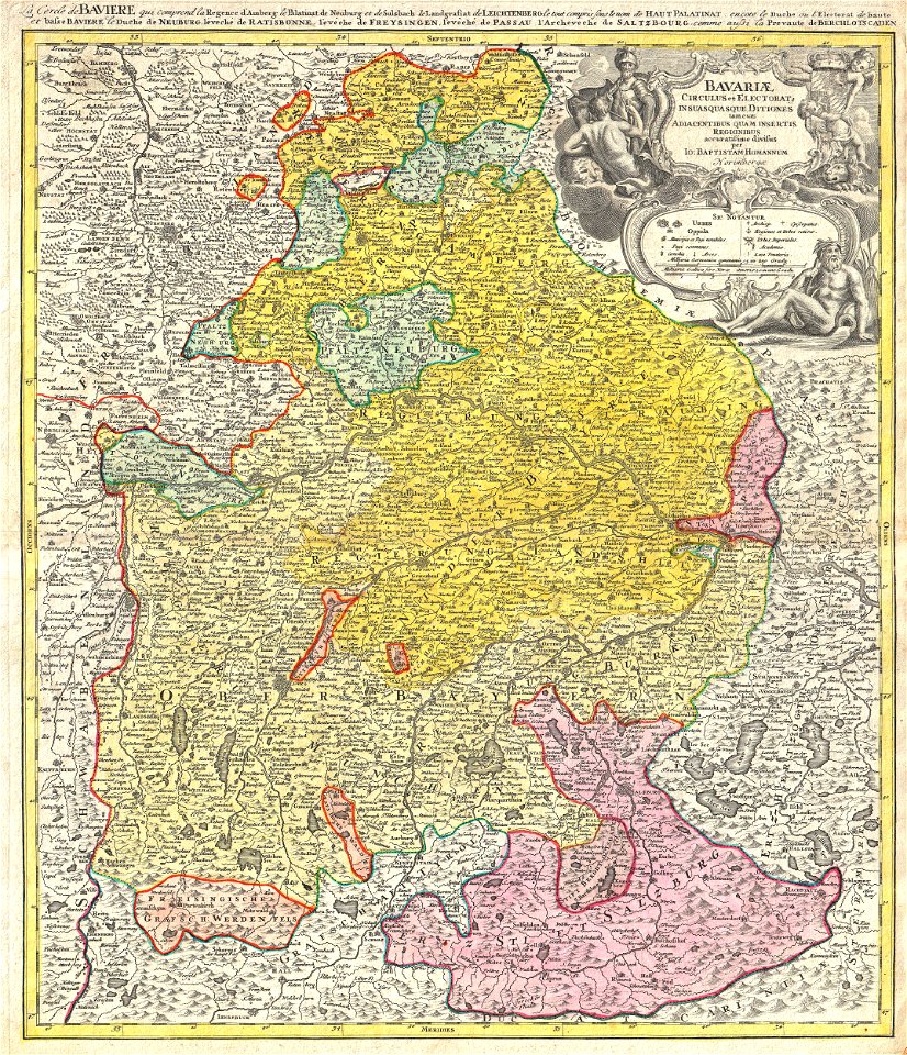
old maps of bavaria
mindelheim
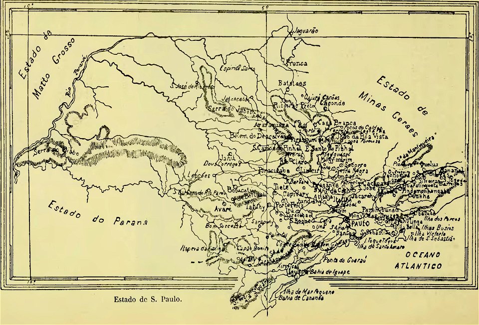
old maps of mato grosso
maps of the deccan sultanates
old maps of santa catarina
old maps of são paulo
old maps of livorno
livorno
giovanni camocio
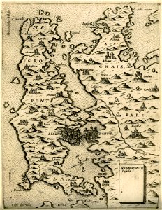
maps of euboea
giuseppe rosaccio
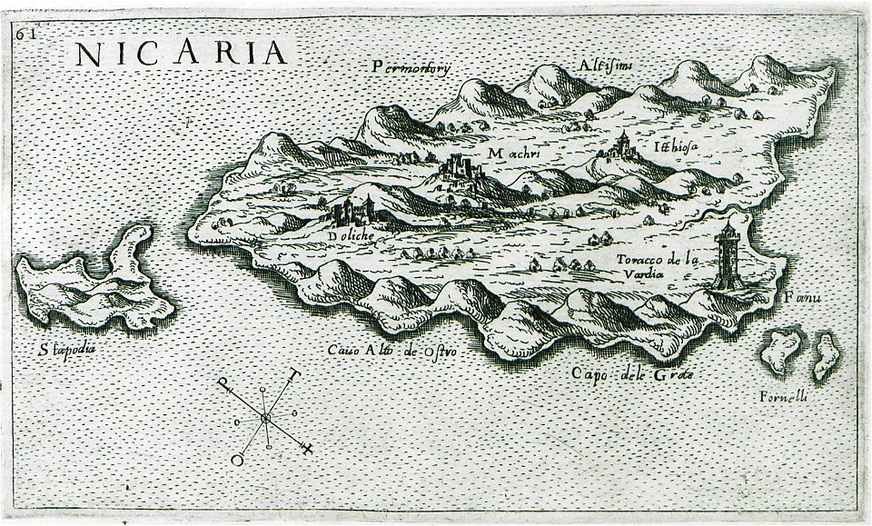
maps of icaria
bouwkundige bijdragen
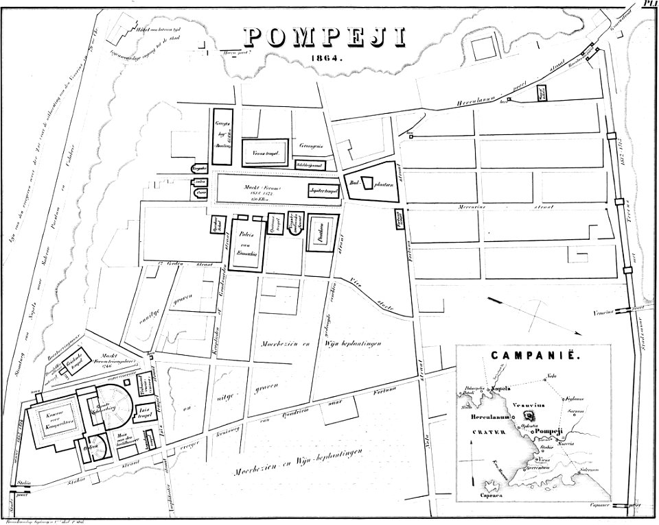
maps of pompeii
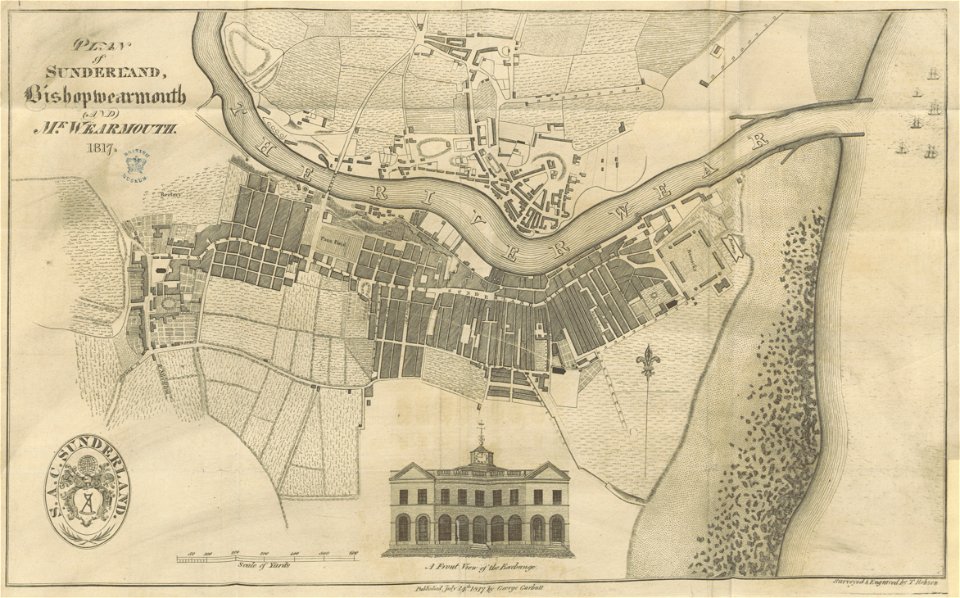
old maps of sunderland
sunderland
potala palace
maps of tibet
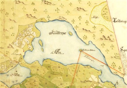
maps of lars kietzlingh
källtorpssjön
maps of karpathos
giovanni camocio
giovanni camocio
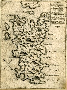
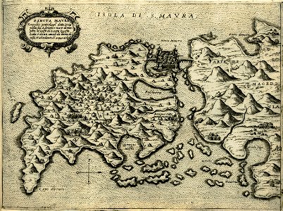
maps of lefkada
holwinde
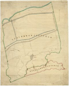
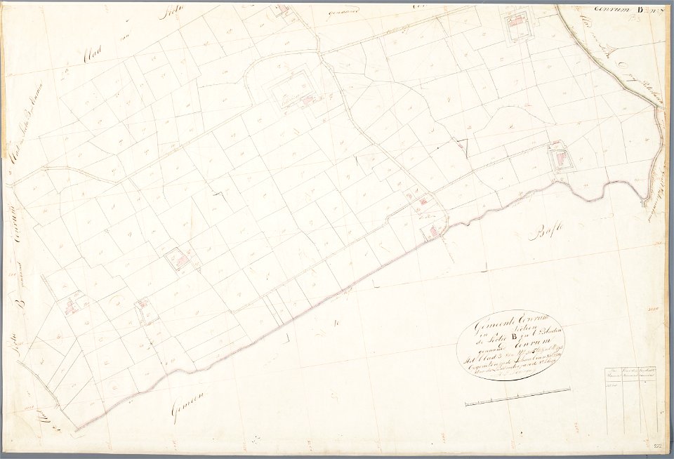
usquert
maps of de marne
eenrum
kammeckers malmgård
maps of östermalm
maps of de marne
eenrum
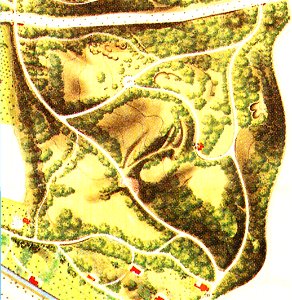
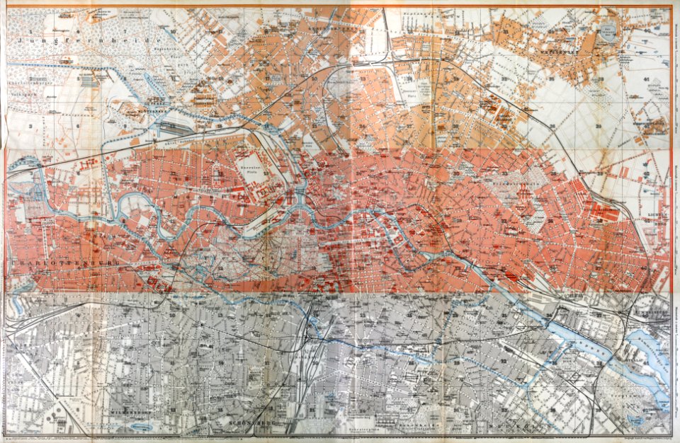
maps of berlin-wannsee
böttcherberg
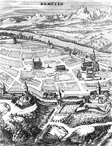
old maps of kempten (allgäu)
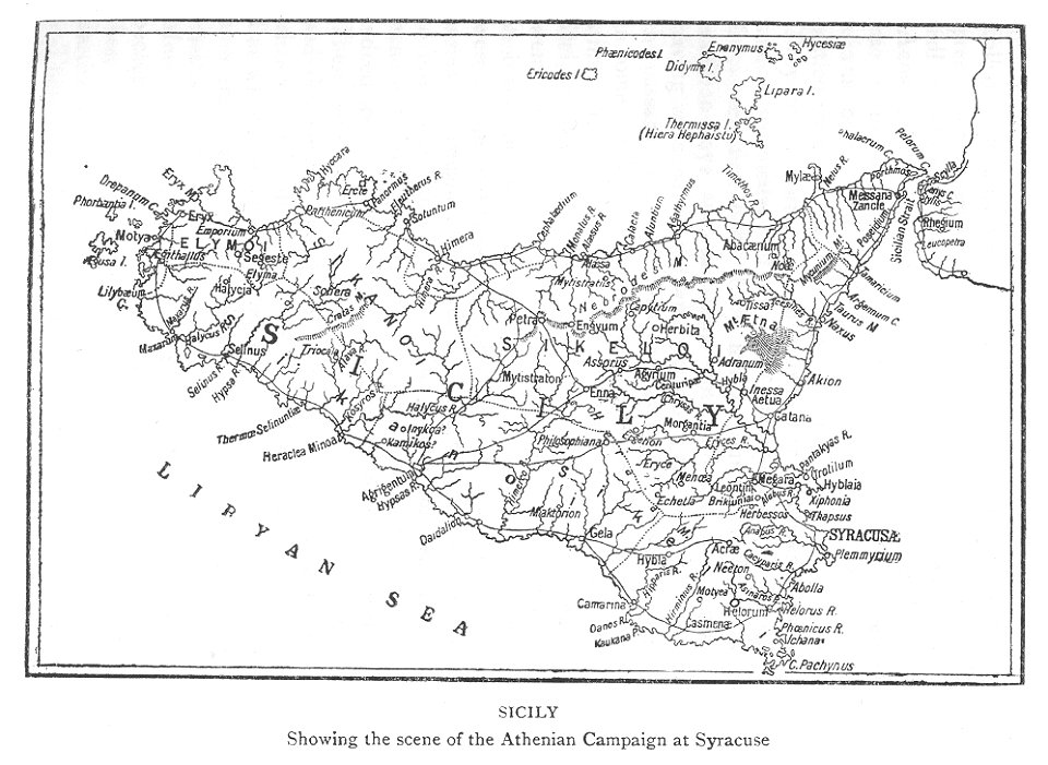
maps of the sicilian expedition
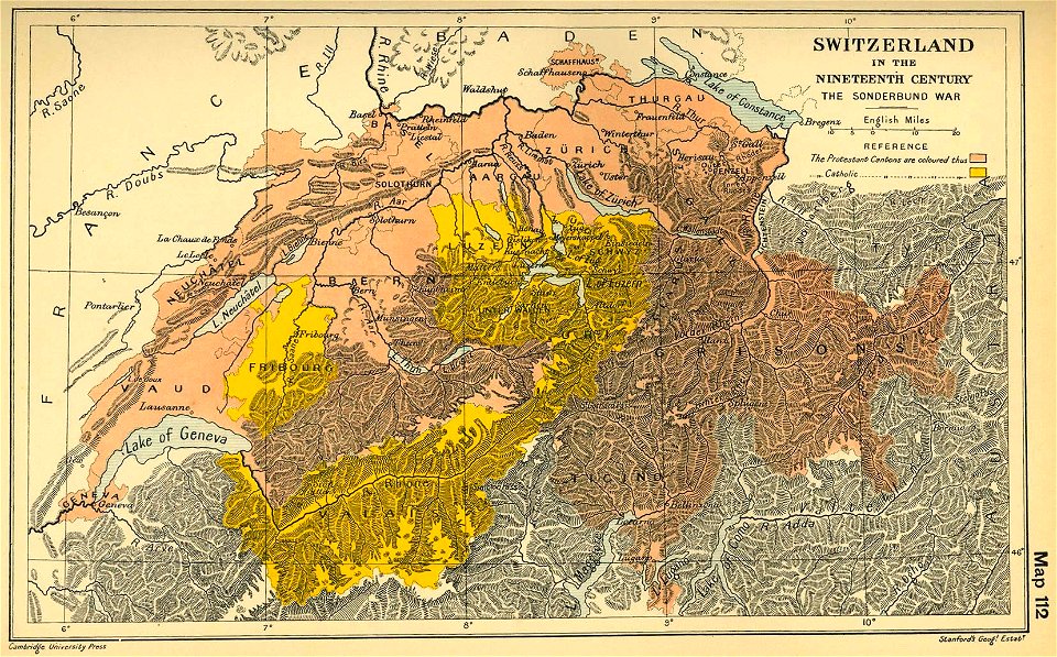
maps of the sonderbund war
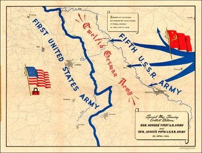
maps of world war ii
stadtbefestigung rinteln
maps of rinteln
17th-century maps of stockholm
17th-century maps of stockholm
stadtbefestigung rinteln
maps of rinteln
stadtbefestigung rinteln
maps of rinteln
19th-century maps of india
19th-century maps of india
19th-century maps of india
19th-century maps of india
19th-century maps of india
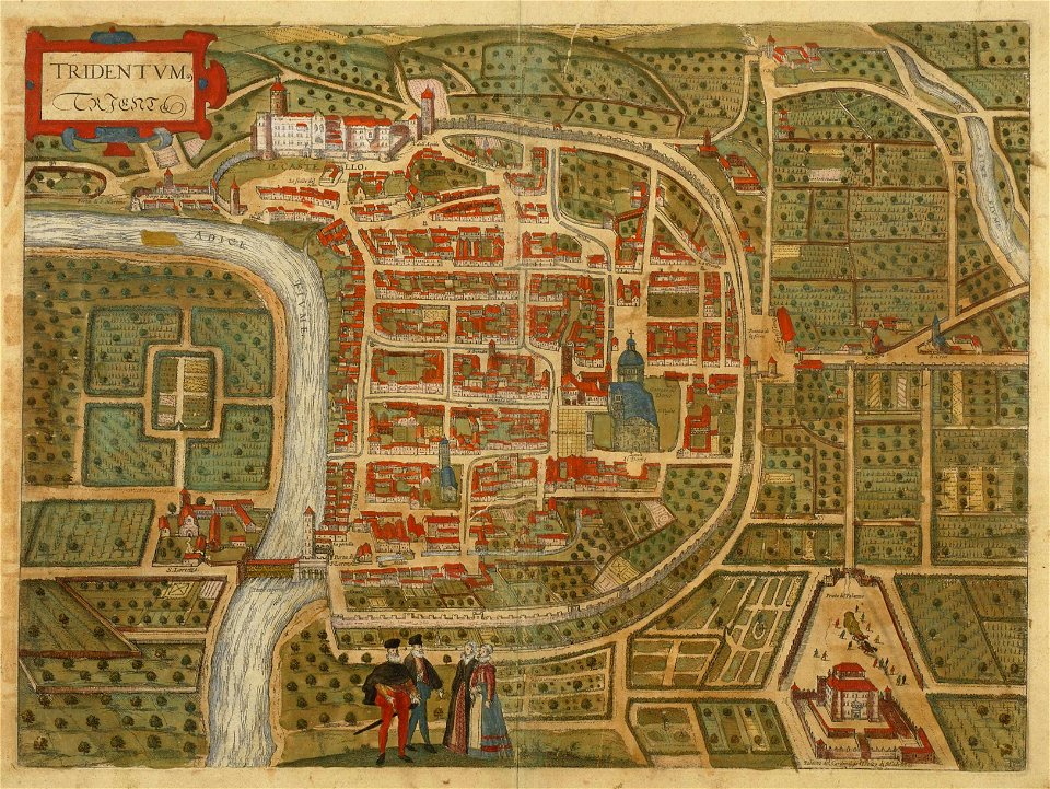
old maps of trento
engraving
stadtbefestigung rinteln
maps of rinteln
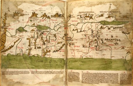
holy land
israelite
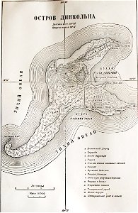
illustrations from the mysterious island by jules férat
russian-language maps
david rumsey historical map collection
maps by william faden
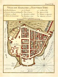
lower manhattan
new york city
maps with cartouches
atlas van der hagen
copper engraving
1645 maps
maps with cartouches
atlas van der hagen
maps made in the 17th century
maps by johannes janssonius
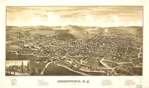
johnstown
new york
charts and maps of the royal museums greenwich
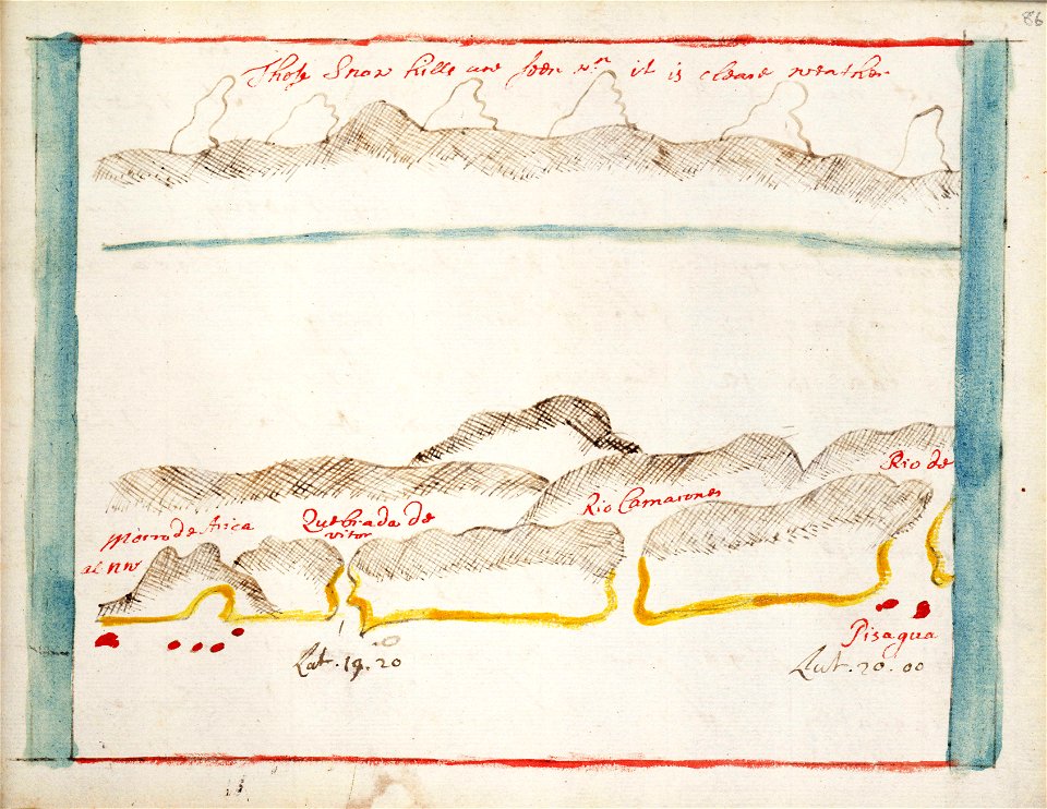
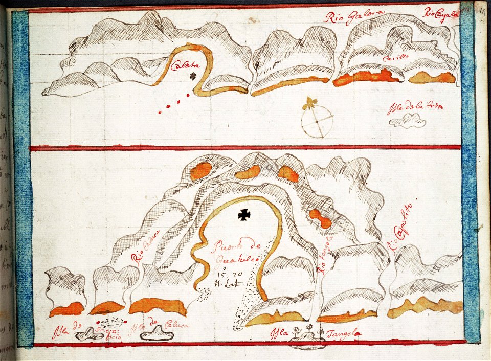
pisagua
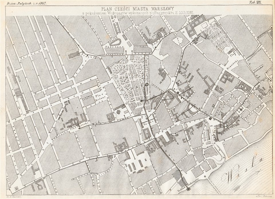
historical maps of warsaw
henryk marconi
new york
warsaw
maps by brockhaus
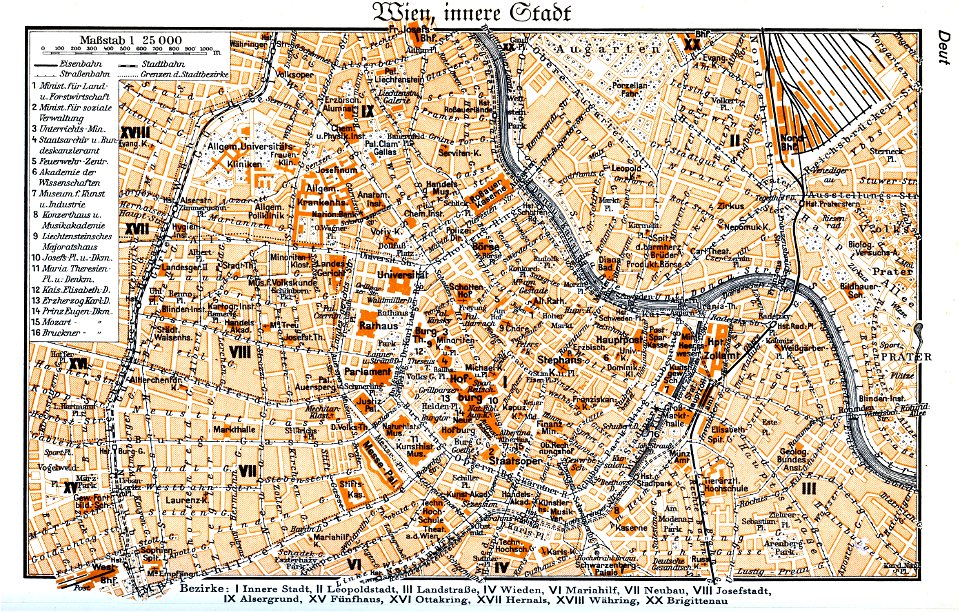
1937 in vienna
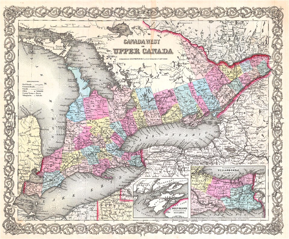
maps by joseph hutchins colton
upper canada
drawings in the universitätsbibliothek salzburg
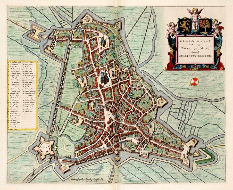
maps made in the 17th century
wagner & debes
1914 in berlin
charts and maps of the royal museums greenwich
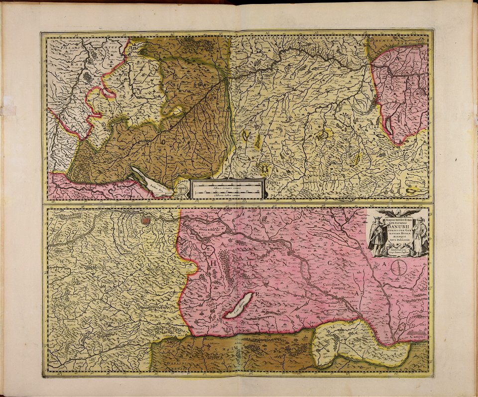
1682 maps
stockholm
mälaren
stockholm
mälaren
johann baptist homann
1728 maps
new york
carthage
1902 maps
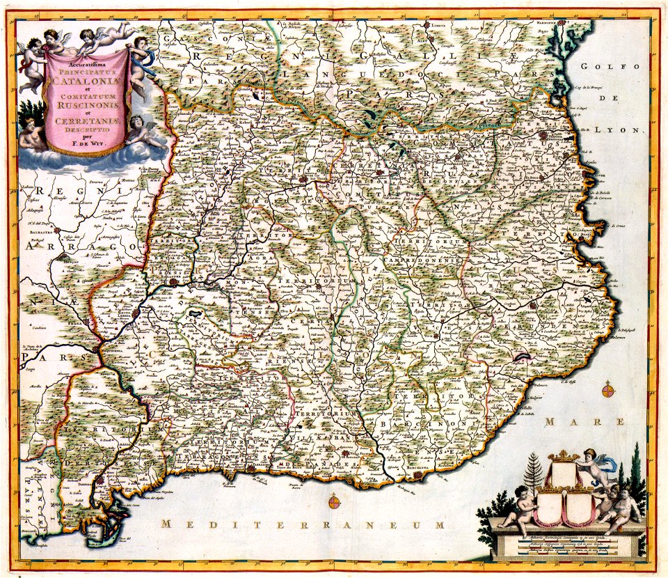
spain
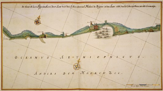
johannes vingboons
1666 maps
david rumsey historical map collection
jr
david rumsey historical map collection
jr
maps by willem and johannes blaeu
atlas van loon
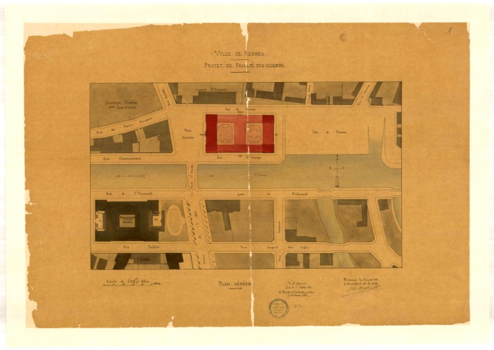
world war ii in rennes
old maps of rennes
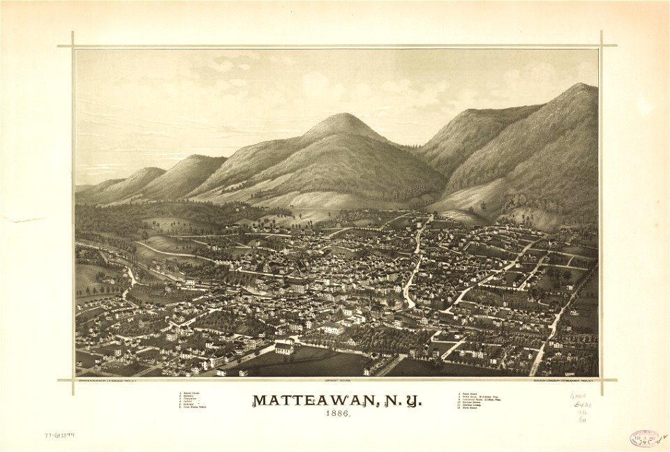
new york
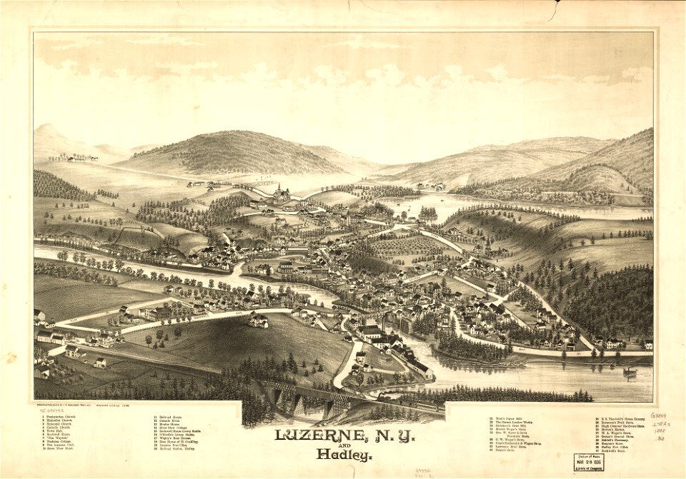
beacon
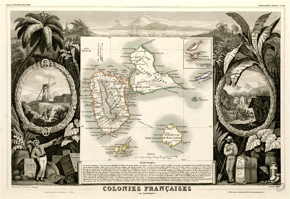
french colonization in africa
military maps
maps in the library of congress
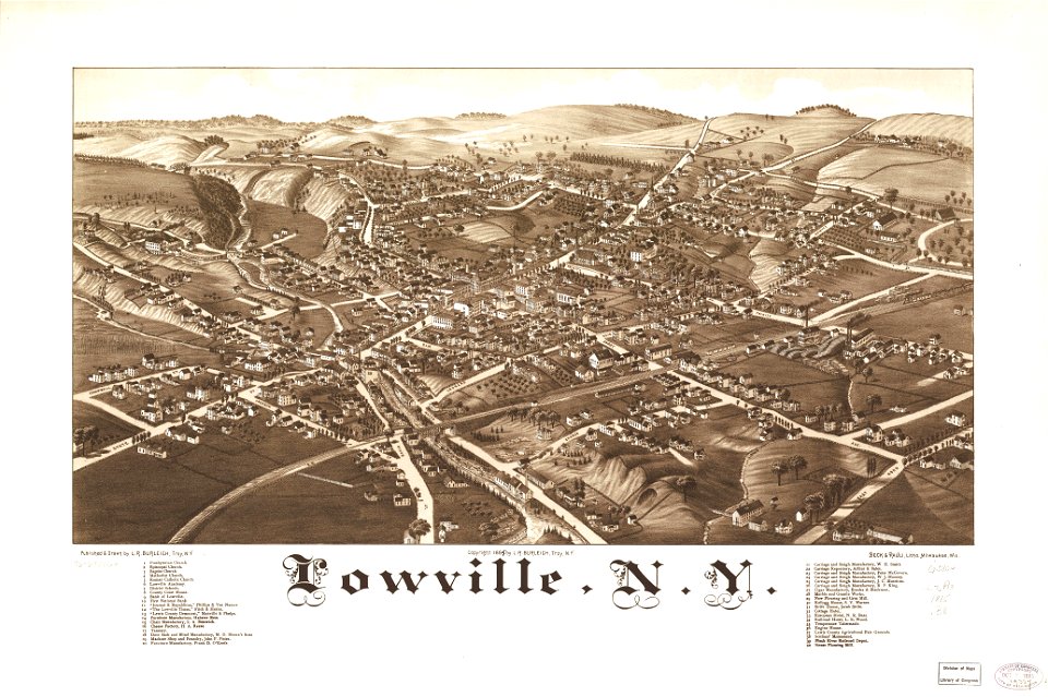
new york
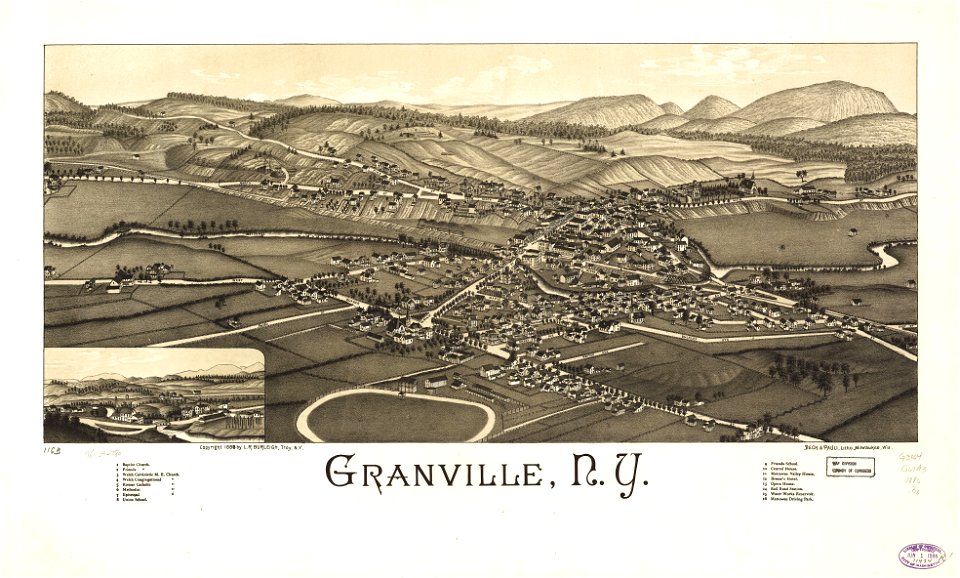
granville
new york
maps in the library of congress
new york
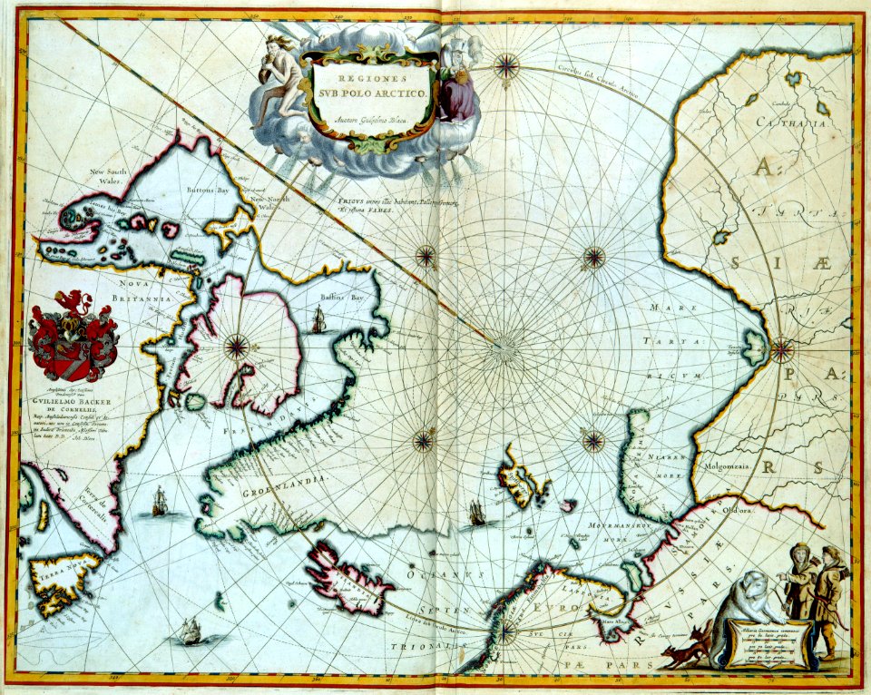
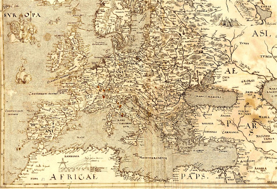
old maps of europe
1570 maps
charts and maps of the royal museums greenwich
1682 maps
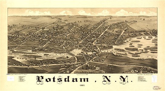
new york
potsdam
new york
hadley
engravings by matthäus merian
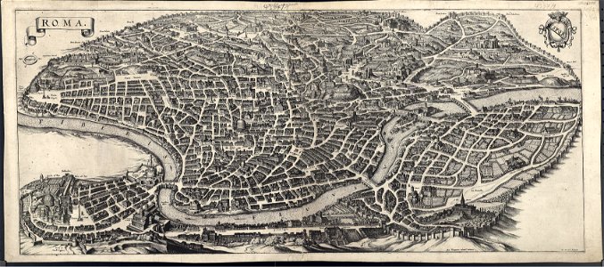
old maps of rome
dutch 17th-century prints in the rijksmuseum amsterdam
petrus scriverius
trịnh lords
1747)
fonds ancely - bibliothèque municipale de toulouse - maps
victor levasseur - maps of the world
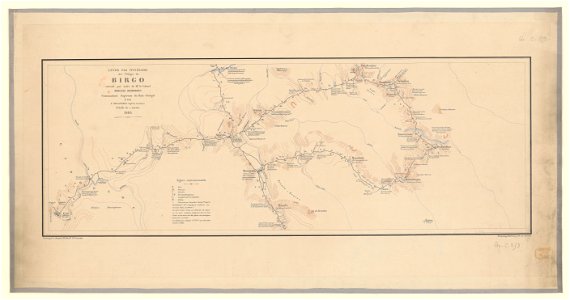
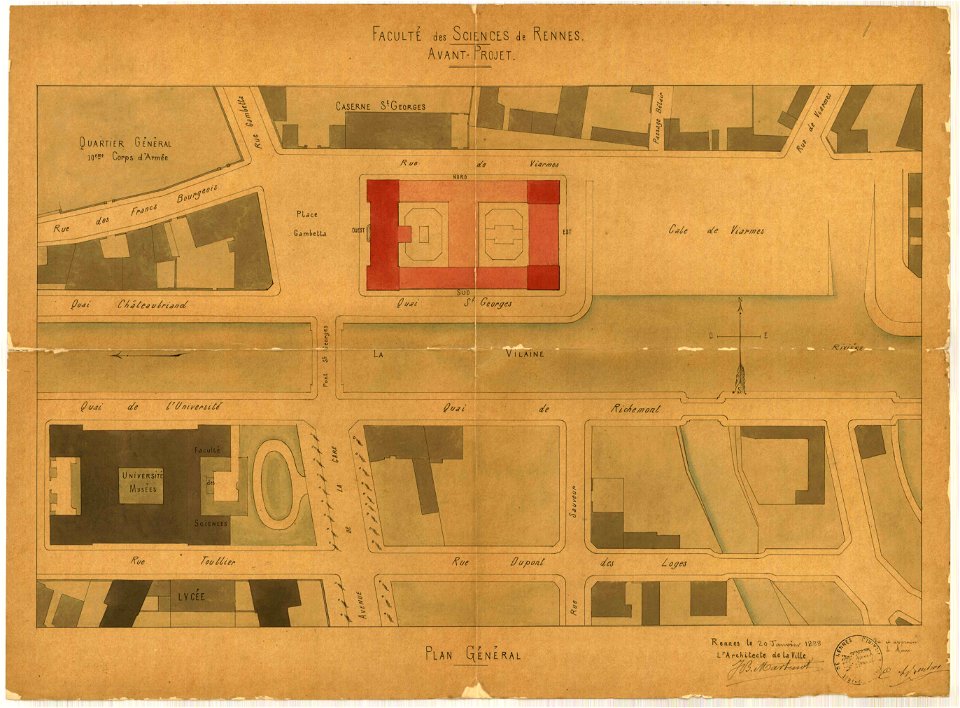
jean-baptiste martenot
1888 in bretagne
jean-baptiste martenot
1888 in bretagne
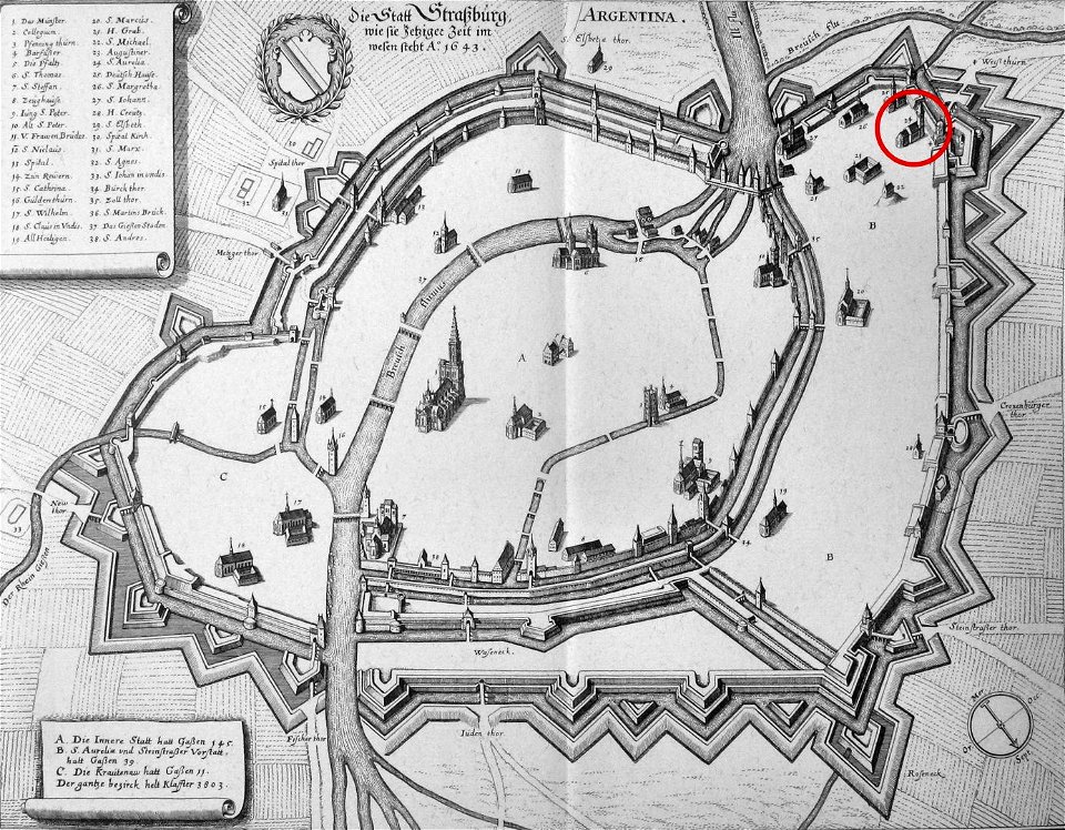
église sainte-aurélie
strasbourg
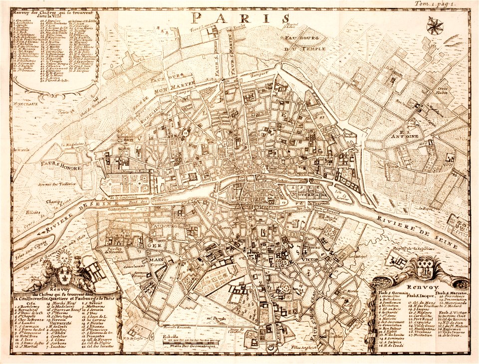
18th-century maps of paris
maps of paris in the 1740s
bird's eye view maps of boston
boston
bird's eye view maps of boston
boston
university of toronto wenceslas hollar digital collection
maps by wenzel hollar
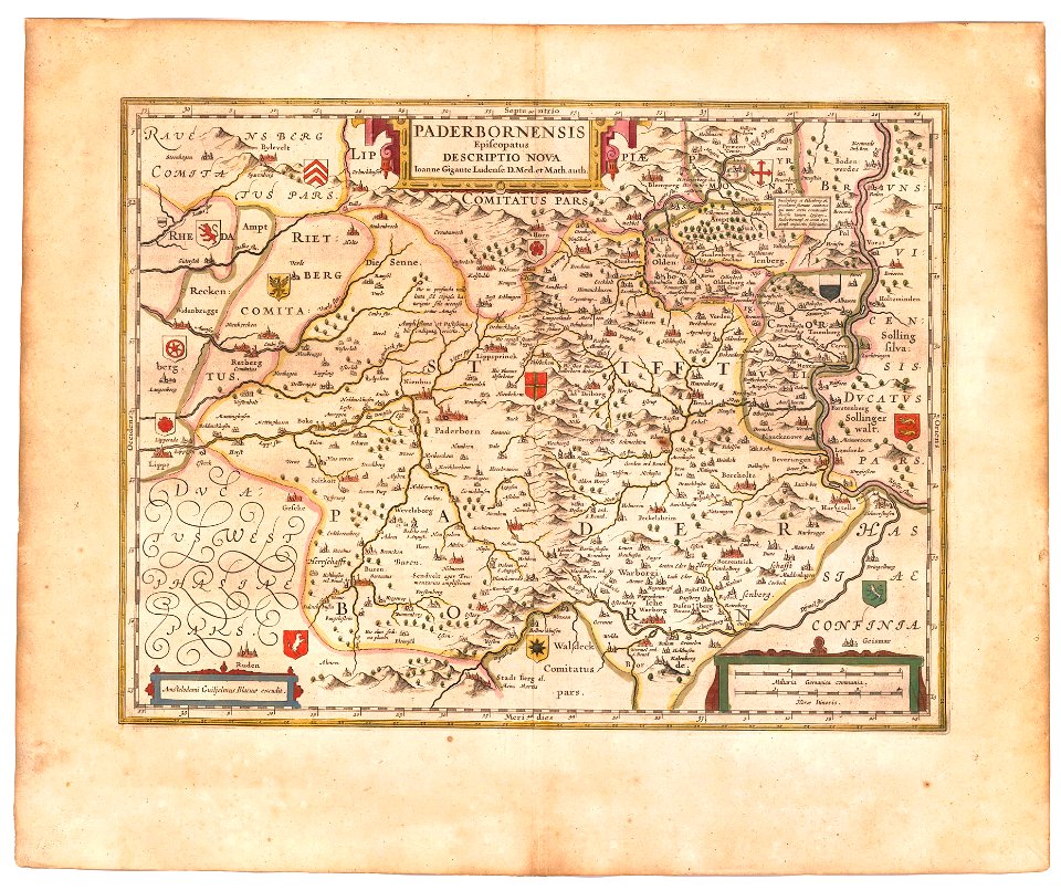
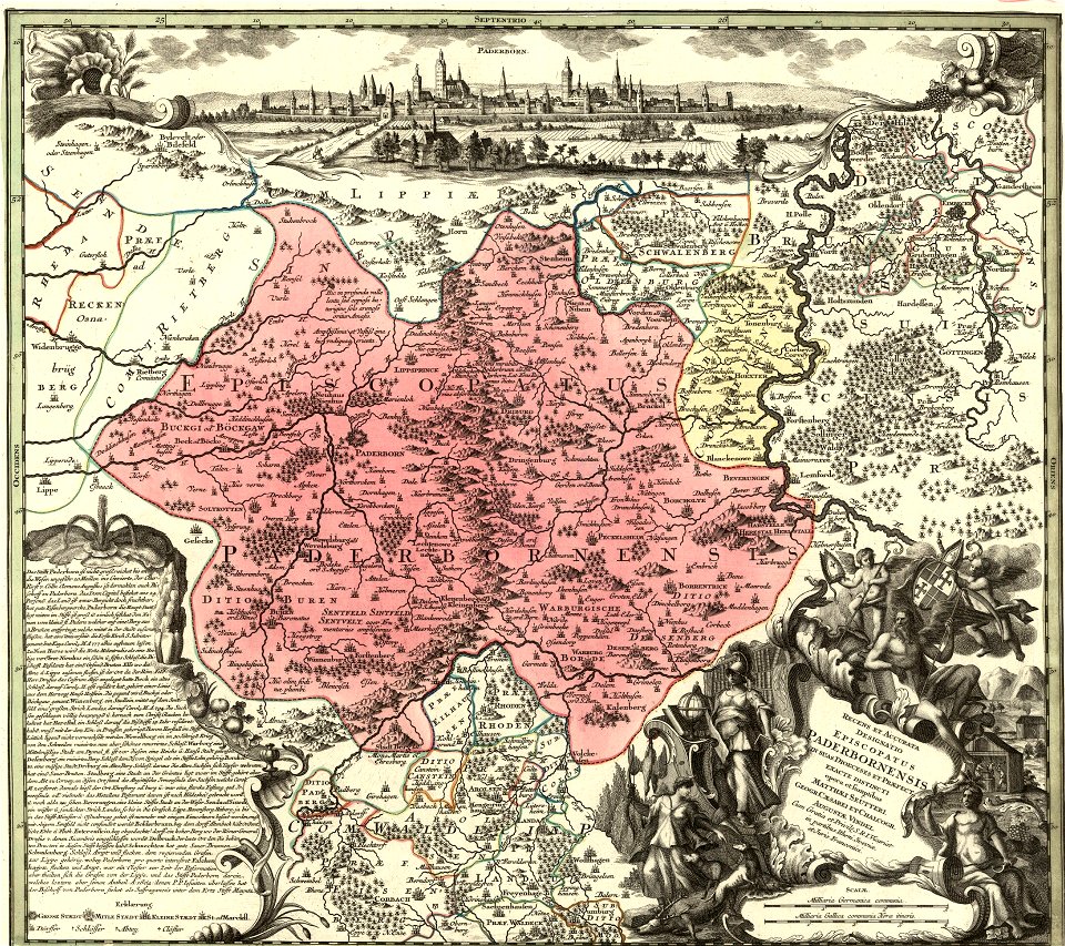
old maps of prince-bishopric of paderborn
atlas novus (blaeu)
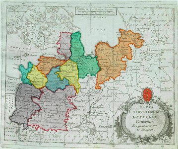
small atlas of the russian empire (1792)
maps of saint petersburg governorate
travels in various countries of europe
asia and africa
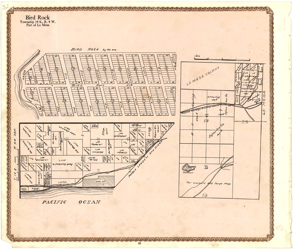
maps in the library of congress
california
maps by matthäus seutter
tobias conrad lotter
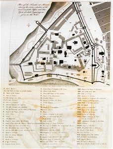
maps of thionville city walls
louis
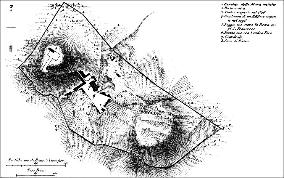
maps of archaeological sites in italy
old maps of tuscany
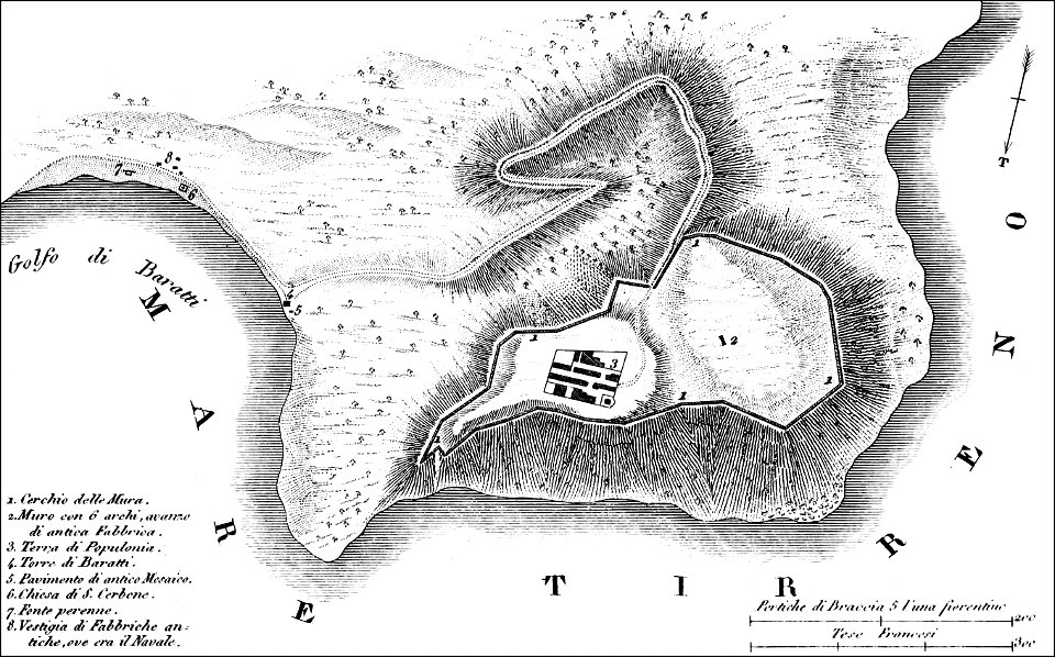
maps of archaeological sites in italy
old maps of tuscany
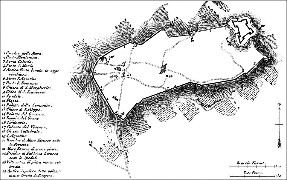
maps of archaeological sites in italy
history of cortona
4101 - 4200 of 1,095,966
Next page
/ 10960